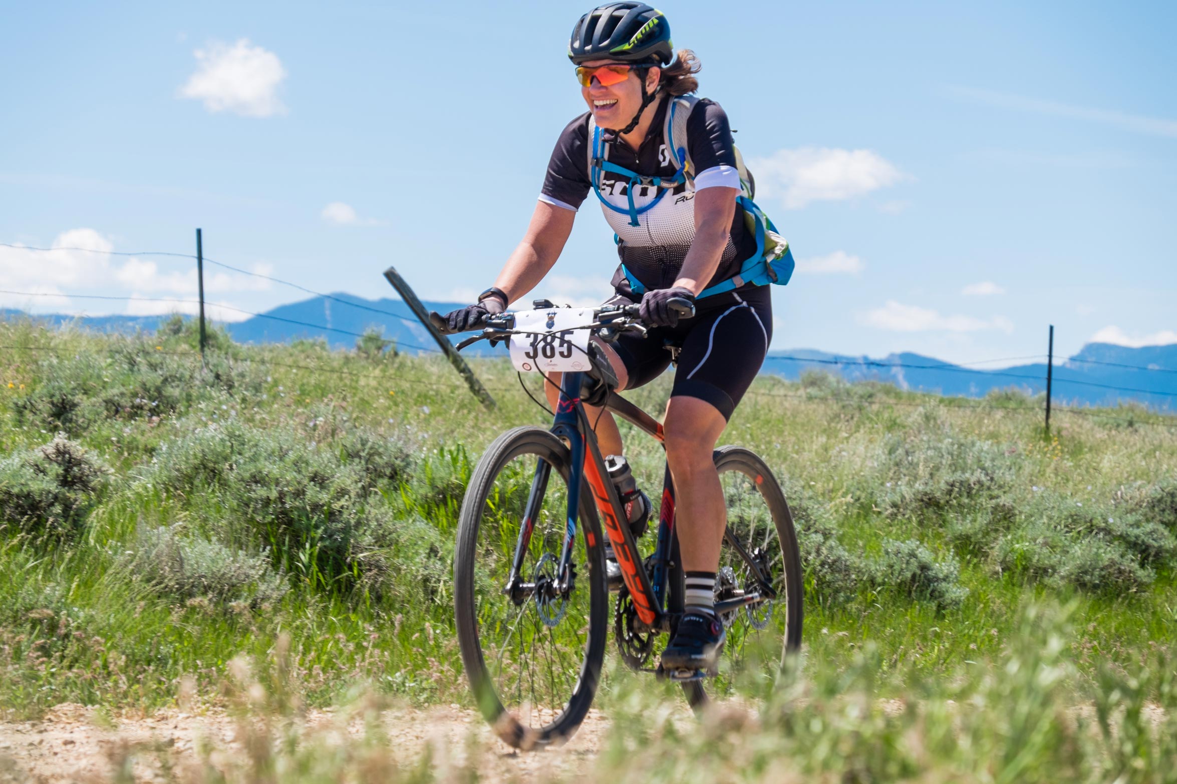
Course Info
To help riders plan accordingly, we will be applying the ISGG (Industry Standard Guide to Gravel). This system breaks down gravel into 4 categories and can be viewed here.
Unsure which bike to ride?
Give Jordan at Sheridan Bicyle Co a call at 307-763-4481.
Aid Station Cutoff Times:
For the safety of riders, we will be stopping anyone who has not made it to the aid station by the following times:
Aid Station 2: 11:30 am
Aid Station 3: 11:00 am
Aid Station 4: 12:30 pm
Aid Station 5: 2:00 pm
Aid Station 6: 3:00 pm
Aid Station 7: 4:00 pm
Aid Station 10: 12 Noon
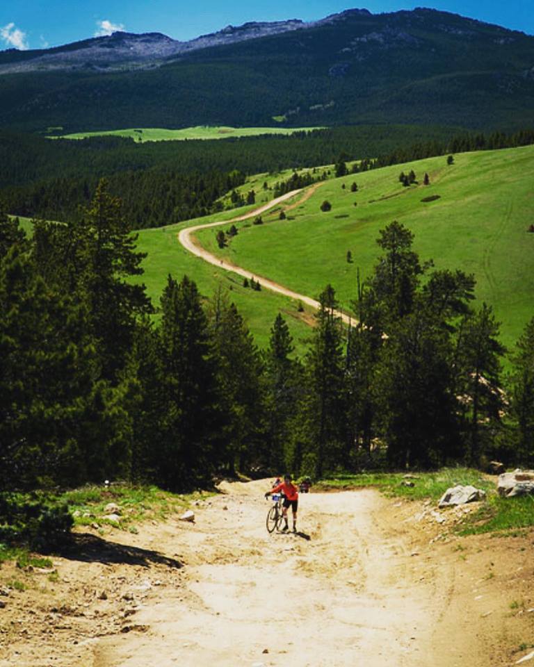
Long Course: 90 Miles
The biggest, baddest dose of Bad Medicine!
- Pavement 25%
- Category 2 15%
- Category 3 45%
- Category 4 15%
A hard tail mountain bike, 40mm tire recommended.
Aid Stations are located approximately every 10 miles
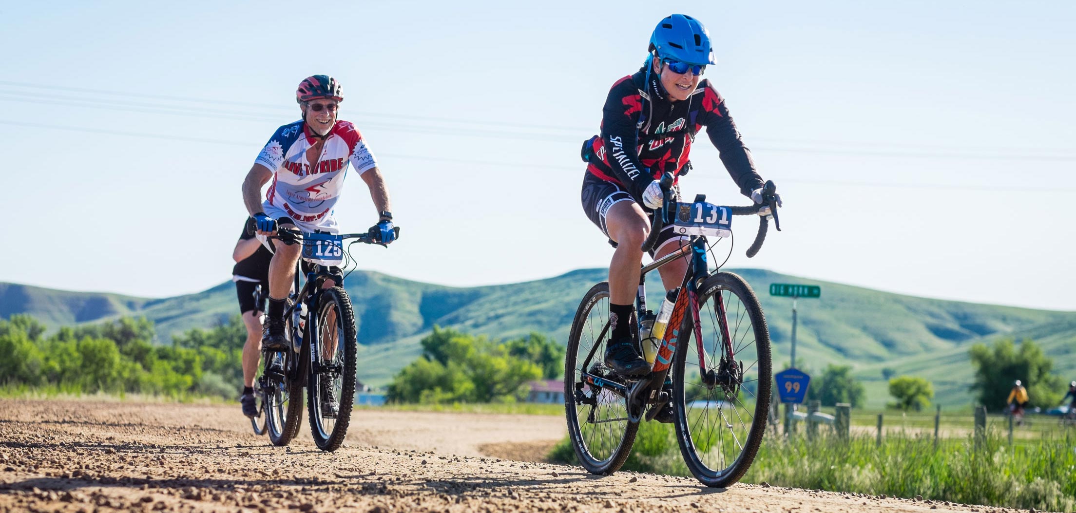
You’ll head southwest out of Shell on Trapper Creek Road. The first 3 miles are paved giving you a nice warm up over some rolling hills. Watch for wild turkeys and pheasants crossing the road.
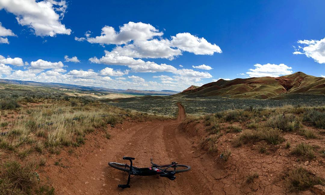
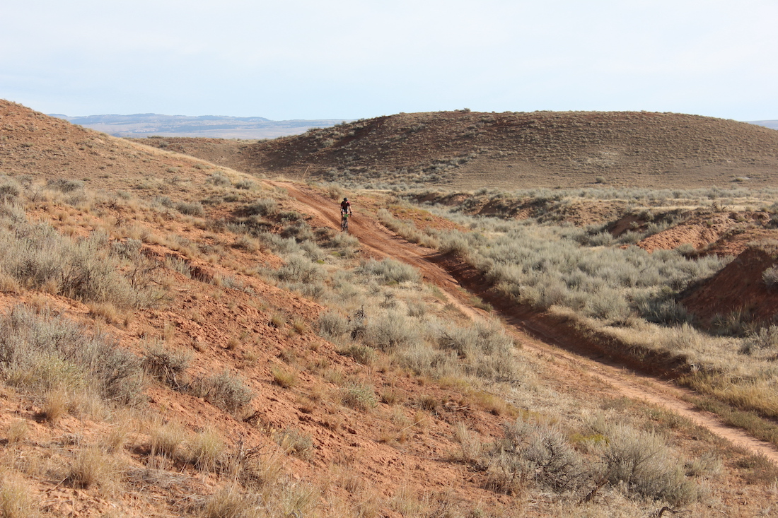
At the Y, you’ll stay right and start the gravel. About 4.5 miles into the course you’ll pass the last hay field and get a glimpse up into Trapper Canyon towards your left. Now the work begins as you leave the maintained gravel and start the section of rugged two-track. Pay attention, this part of the course is the most raw and technical.
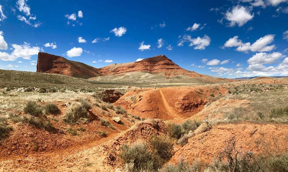
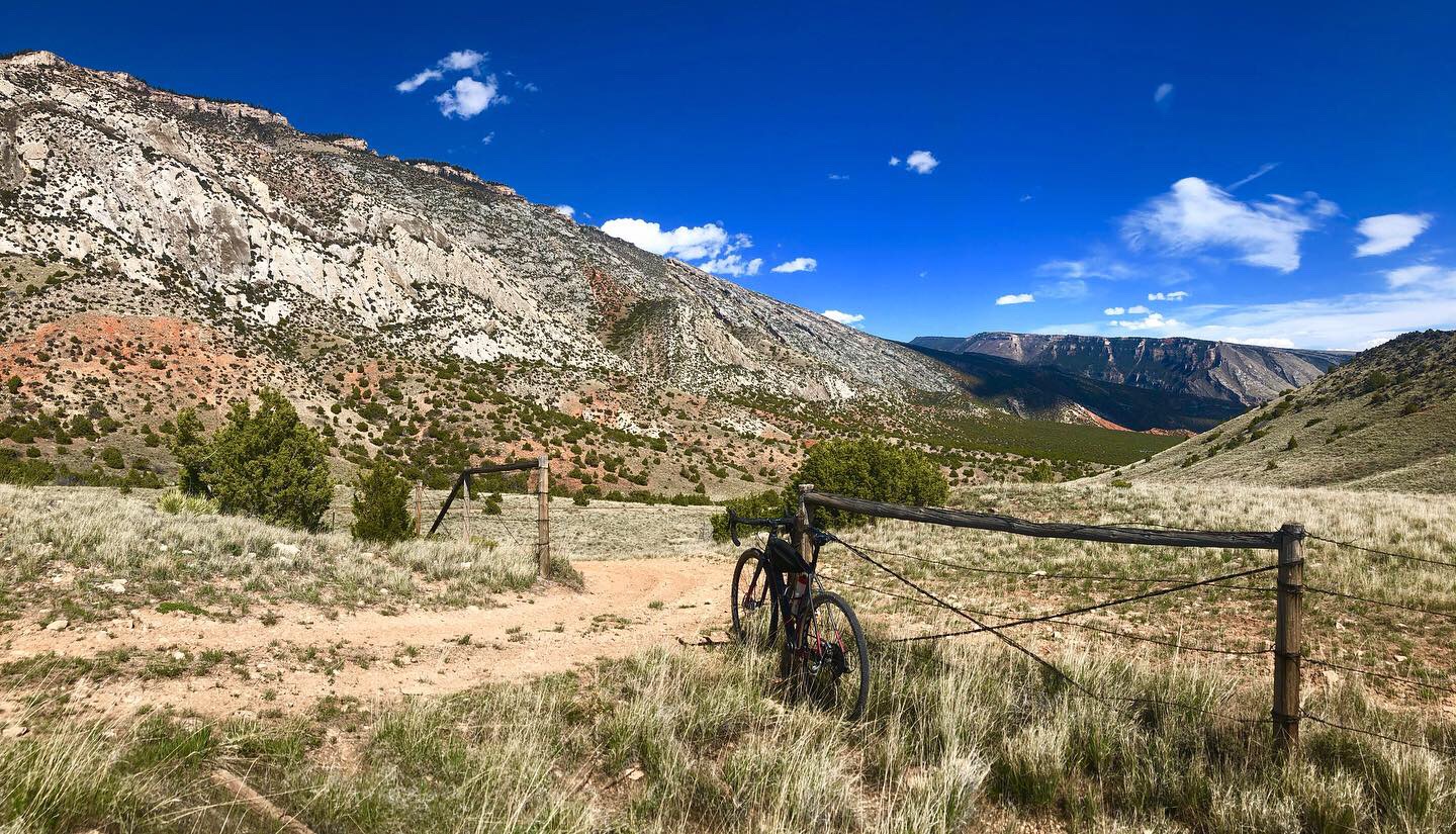
6.5 miles into the course, you’ll get an excellent view of Devils Leap. This impressive geological features towers 800 feet in the air. Next you’ll ride through Red Basin. As the sun climbs, these vivd red and orange cliffs will change color. 10.5 miles into the ride, you’ll reach the Red Gulch Road – a welcome sight after the tough terrain of Red Basin. At this point you’ve climbed about 1100 feet. This backcountry byway will continue to ascend another 1700 feet until you reach the Alkali Road where you’ll turn right and descend the next 9 miles towards Hyattville. Take the opportunity to recharge a little – the best is yet to come!
After taking the back entrance into Medicine Lodge Archaeological Site it’s time for a change of scenery. You’ll head north on the Cold Springs Road towards Bighorn National Forest. Good thing you rested up as you coasted downhill for 9 miles, because you’ve got a monster climb in front of you – 4,900 feet over 21 miles. Don’t worry, that’s only 233 feet per mile – you’ve got this.
Once at the top, another aid station awaits. The cool mountain air will refresh you as you take USFS 17 for the next 23 miles (there will be an aid station in this section as well). You’ll pass Paintrock and Medicine Lodge Lakes, Spanish Point, Crooked Creek Hill and Snowshoe Mountain. The big climb may be over but It’s not easy street. As you make your way towards US14 you will face a few more ups and downs on some category 3 roads. When you reach Ranger Creek Station, make a note to come back. The Bench Trail, an excellent mountain bike trail, starts here (but that’s an adventure for another day). When you reach US14, flaggers will warn uphill traffic for you.
Once on US 14, it’s a feast for the eyes as you descend through Shell Canyon. Shell Creek is your companion as you admire Copmans Tomb, Shell Falls, and Elephant Head Rock. While your legs will appreciate the break, stay alert – hairpin turns and switchbacks require your full attention. When the canyon narrows at the bottom the sound of Shell Creek rushing by tells you you’re almost home.
Once at the bottom of the canyon, it’s time for the final push home. The next 5 miles have a gentle descent back to Shell through rolling ranch land. Check out iconic Chimney Rock on your left before cruising back into town.
Medium Course: 56 Miles
A medium and gritty dose of Bad Medicine!
- Pavement 40%
- Category 2 25%
- Category 3 20%
- Category 4 15%
A hard tail mountain bike, 40mm tire recommended.
Aid Stations are located approximately every 10 miles
You’ll head southwest out of Shell on Trapper Creek Road. The first 3 miles are paved giving you a nice warm up over some rolling hills. Watch for wild turkeys and pheasants crossing the road.
At the Y, you’ll stay right and start the gravel. About 4.5 miles into the course you’ll pass the last hay field and get a glimpse up into Trapper Canyon towards your left. Now the work begins as you leave the maintained gravel and start the section of rugged two-track. Pay attention, this part of the course is the most raw and technical.
6.5 miles into the course, you’ll get an excellent view of Devils Leap. This impressive geological features towers 800 feet in the air. Next you’ll ride through Red Basin. As the sun climbs, these vivd red and orange cliffs will change color. 10.5 miles into the ride, you’ll reach the Red Gulch Road – a welcome sight after the tough terrain of Red Basin. At this point you’ve already climbed about 1100 feet. This backcountry byway will steadily climb another 2700 feet until your left turn at Alkali Road. At this point you’re halfway up – only 2700 more feet to go! As you climb, the scenery begins to change from desert to forest.
Once on top, an aid station will be available. Now that you’re in the mountain air, cruise the next 14 miles down USFS 17 towards Crooked Creek Hill. The big climb may be over but It’s not easy street. As you make your way towards US14 you will face a few more ups and downs on some category 3 roads. When you reach Ranger Creek Station, make a note to come back. The Bench Trail, an excellent mountain bike trail, starts here (but that’s an adventure for another day). When you reach US14, flaggers will warn uphill traffic for you.
Once on US 14, it’s a feast for the eyes as you descend through Shell Canyon. Shell Creek is your companion as you admire Copmans Tomb, Shell Falls, and Elephant Head Rock. While your legs will appreciate the break, stay alert – hairpin turns and switchbacks require your full attention. When the canyon narrows at the bottom the sound of Shell Creek rushing by tells you you’re almost home.
Once at the bottom of the canyon, it’s time for the final push home. The next 5 miles have a gentle descent back to Shell through rolling ranch land. Check out iconic Chimney Rock on your left before cruising back into town.
Short+ Course: 32 Miles
NEW COURSE FOR 2022!
- Pavement 40%
- Category 2 25%
- Category 3 35%
A gravel or hard tail mountain bike is appropriate for this course.
An aid station is located at approximately mile 12
A new course for 2022 incorporates the same beginning course as the 56 and 90 mile but returns on Red Gulch road rather than turning up the mountain. It is a great distance at 32 miles but a spicier terrain than the regular short course.
From Shell, you will head east on Trapper Creek road. The first 3 miles are paved. At the end of the pavement you will stay right. About 4.5 miles into the course you’ll pass the last hay field and get a glimpse up into Trapper Canyon. Now the work begins as you leave the maintained gravel and start the section of rugged two-track. Pay attention, this part of the course is the most technical.
6.5 miles into the course you will get an excellent view of Devils Leap. It is impressive at 800 feet tall. Next you will ride through Red Basin. 10.5 miles into the ride you will reach Red Gulch Road. Here you will turn right and head northwest.
Once you reach US Highway 14, you will take a left followed by an immediate right onto Beaver Creek Road. After a few miles you will turn right onto Lane 31 and head east.
At Horse Creek road turn LEFT and head north. In approximately 1.5 miles you will turn right and head into BLM land. Follow the course markgings back to US Highway 14. Enjoy the last easy quarter mile back to Shell and the finish line!
Short Course: 25 Miles
An entry level dose of Bad Medicine!
- Pavement 50%
- Category 2 50%
A gravel bike is appropriate for this course.
An aid station is located at approximately mile 12
This course is an “out and back”. It departs Shell and utilizes the gravel roads of Horse Creek and County Lane 31 to connect with paved sections of Beaver Creek Road and County Road 36. Then, it connects with the Red Gulch Road eventually taking you to the Red Gulch Dinosaur Tracksite where an Aid Station awaits. Refresh yourself and head back to Shell on the same route.
Until Race Day
Day(s)
:
Hour(s)
:
Minute(s)
:
Second(s)
Bad Medicine is operated under special use permit from the Bighorn National Forest, and is an equal opportunity service provider.
© 2023 Shell Recreation Development LLC
All Rights Reserved